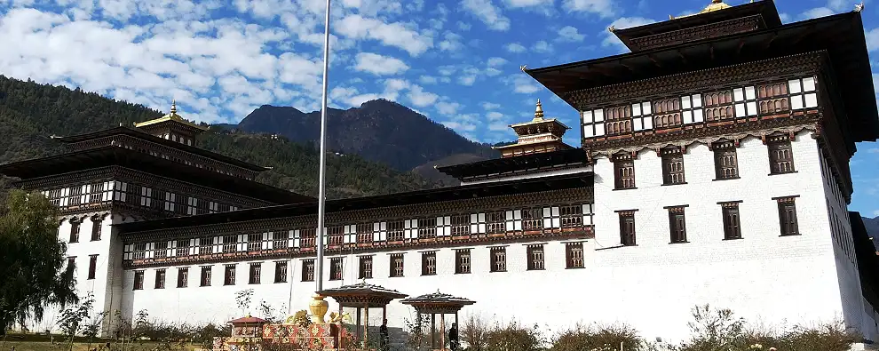
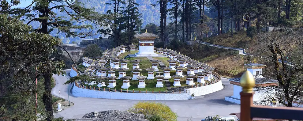
This was the old capital of Bhutan and now a tourist hotspot. It is located between the confluence of two rivers Pho chhu and Mo chhu. It is quite warm in winter and hot in summer. It is located at an elevation of 1200 meters. Punakha is bordered by Thimpu, Gasa and Wangdue Phodrang dzongkhag. Rimpung Dzong literally means Heap of Jewels was built in the year 1646 by Shabdrung Nawang Namgyel. It is now the centre of administrative and religious authority of Paro valley. On a clear day experience an unforgettable view of Mount Jumolhari, 7,314 meters is stunning from here. Punakha to Wangdi Phodrang is 13 kilometers and 45 minutes drive. This valley is famous for rice farming. Both red and white rice are grown along the river valley of Pho and Mo Chu. The view over the Himalayas at Dorchula pass, at 3150 meters is spectacular. The sight of the alpine snows and a wide range of colourful rhododendron amongst the soft green of wild herbs make this place a tourist spot. Punakha to Wangdiphodrang is nearly 45 minutes drive and is a beautiful tourist spot.
To See
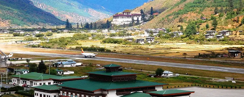
By Air - Punakha to Paro is 142 kilometers and 4 ½ hours drive. Paro is the only airport in Bhutan. Drukair is the national carrier, connecting Paro to Bangkok (Thailand), Dhaka (Bangladesh), Kolkatta, and Delhi (India), and Kathmandu (Nepal). During the monsoon season, flights are often delayed by cloud cover. The other Airport is Bagdogra. Punakha to Phuentsholing is 250 kilometers and 8 hours drive. Phuentsholing to Bagdogra Airport (IXB) is 180 kilometers and 4 hours drive. Bagdogra is connected to Kolkata, Delhi, etc and other Indian cities by flight.
By Rail – Punakha to Phuentsholing is 250 kilometers and 8 hours drive. Phuentsholing to New Jalpaiguri Railway Station (NJP) is 180 kilometers and 4 hours drive. Bhutan has no railway system but it’s on the anvil. A proposed railway track will be laid with Indian Railways soon. The nearest major railway station is in New Jalpaiguri. Phuentsholing to Hashimara is nearly 18 kilometers and ½ hours drive. Banarhat and Hashimara are the closest railway stations but the frequency rate of train is less.
By Road – It is about 72 kilometers away from Thimpu and it takes about 3 hours drive. Punakha is 250 kilometers from Phuentsholing and nearly 435 kilometers from Siliguri. Punakha to Wangdi Phodrang is 13 kilometers and 45 minutes drive. Bhutan’s main road is the Lateral Road. The road starts in Phuentsholing on the Indian border and terminates in Trashigang in the East. It has branches to other main centers such as Paro, Thimpu and Punakha. On the Indian side National Highway number 31 is close to Jaigaon / Phuentsholing. Buses for Bhutan either start or have a stoppage from Tenzing Norgay Bus Terminus in Siliguri. Bhutan Calcutta bus service is also quite popular.