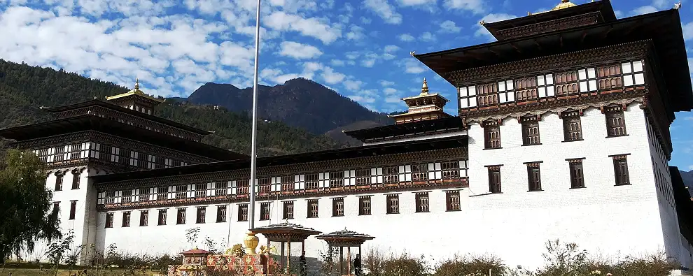
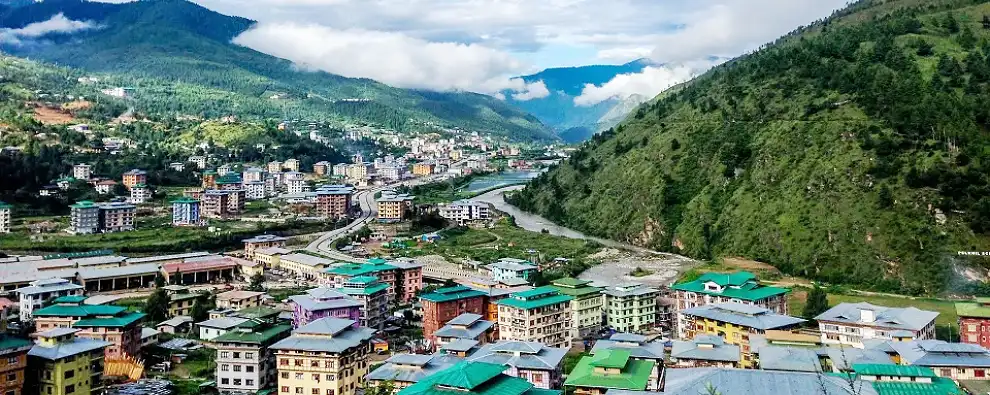
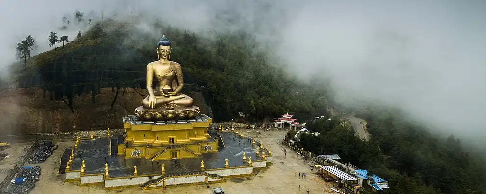
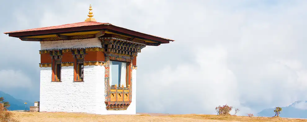
Thimpu is the capital of Bhutan, and also the largest population centre in the country. It is located at 27° 28′ 00″ north, 89° 38′ 30″ East coordinates. The elevation of Thimpu is 2320 meters / 7656 feet. The city sprawls across the western slopes of the Wang Chhu river valley, with a government quarter centered on Tashichoedzong. Norzin Lam, the main thoroughfare, is lined with shops, restaurants, retail arcades and public buildings. All buildings are designed in traditional style with Buddhist paintings and motifs. A lively weekend market near the river supplies meat, vegetables and tourist items. The city is surrounded by forests which make the city look even greener. The 2008 celebrations of 100 years of Monarchy and the city is being decorated / beautified. Dechenchoeling Palace, the official residence of the King, is located close to the town. A stroll in the Norzin Lam road will offers good insight into lifestyle of local people. This road is the main thoroughfare and is a blend of the old and new. King's Memorial Chorten.
To See
By Air - Drukair is the national carrier, connecting Paro to Bangkok (Thailand), Dhaka (Bangladesh), Kolkatta, and Delhi (India), and Kathmandu (Nepal). During the monsoon season, flights are often delayed by cloud cover. Paro is 65 kilometers from Thimpu. Thimpu to Phuentsholing is 176 kilometers, 6 hours drive. The other Airport is Bagdogra. Phuentsholing to Bagdogra Airport (IXB) is 180 kilometers / 4 hours. Bagdogra is again connected with other Indian cities.
By Rail – Bhutan has no railway system but it’s on the anvil. A proposed railway track will be laid with Indian Railways soon. The nearest major railway station is in New Jalpaiguri. Thimpu to Phuentsholing is 176 kilometers, 6 hours drive. Phuentsholing to New Jalpaiguri Railway Station (NJP) is 180 kilometers / 4 hours. Phuentsholing to Hashimara is nearly 18 kilometers and ½ hours drive. Banarhat and Hashimara are the closest railway stations but the frequency rate of train is less.
By Road – Thimpu to Phuentsholing is 176 kilometers, 6 hours drive. Phuentsholing to New Jalpaiguri Railway Station (NJP) is 180 kilometers / 4 hours. On the Indian side National Highway number 31 is 18 kilometers from Phuentsholing. All the buses plying through National Highway 31 either for Guwahati or North east India pass through this region. Jaigaon is the nearest Indian town. Buses for Bhutan either start or have a stoppage at Tenzing Norgay Bus Terminus in Siliguri. Bhutan Calcutta bus service is also quite popular.